|
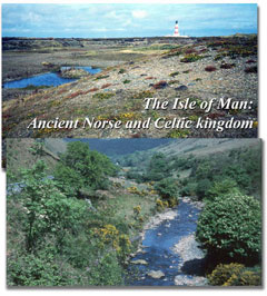
The Isle of Man
Ancient Norse and Celtic Kingdom
(Click on images for slide show...)
The Isle of Man is situated in the northern part of the Irish Sea, nearly equidistant from England, Wales, Scotland and Ireland. It is 53 km long with an area of 572 km.2. Its human population is about 84,000. More that 40% of the Island is uninhabited hill land. Snaefell is the highest point, at 620 metres: off the southern tip is the islet known as the Calf of Man.
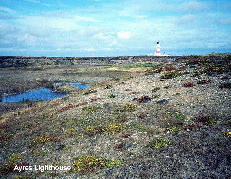
 The Island’s many unspoilt habitats support a great diversity of wildlife, from grey seals and basking sharks to the protected lesser mottled grasshopper of Langness. The island is home to many different bird species, including chough, peregrine, long-eared and short-eared owls, puffin and Manx shearwater. Ballaugh Curraghs, the island’s only Ramsar site, is a large marshland in the north of the Island, and has had the biggest hen harrier roost in Western Europe. This reserve and the Calf of Man (on which there has been a bird observatory for more than 50 years) are among the sites managed by the Manx Museum. The Isle of Isle of Man Department of Environment, Food and Agriculture (DEFA) manages the hills and glens, and has designated the Ayres as a National Nature Reserve for its extensive coastal heath, dunes and shoreline with breeding little terns. The other statutory protected sites include Langness, Greeba mountain and Dalby Coast. The Manx Wildlife Trusthas 20 reserves across the Island, including the famous orchid meadows at Close Sartfield. In the late 1990’s the Trust took the lead in the production of Biodiversity Action Plans (BAPs) and has commissioned various surveys: coastal, verges and river corridors. Habitat surveys and the BAP process are now being led by DEFA. The Wildflowers of Mann project raises native wildflowers and tests grassland management techniques.

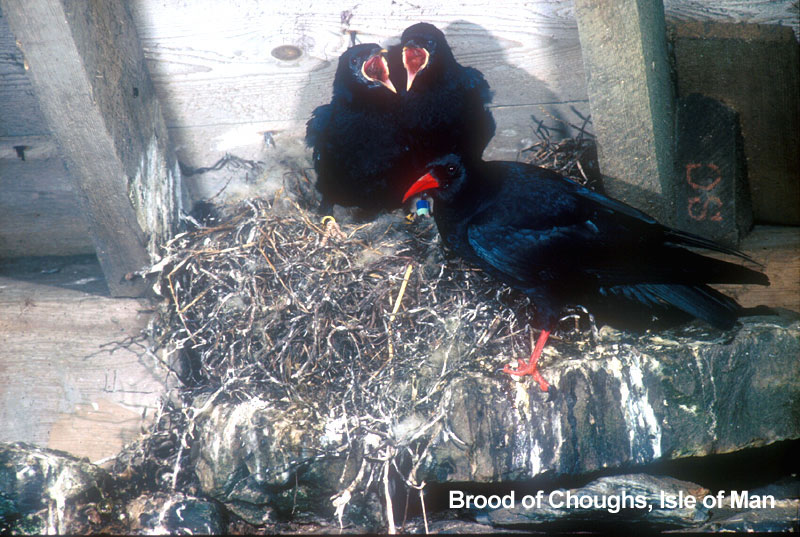
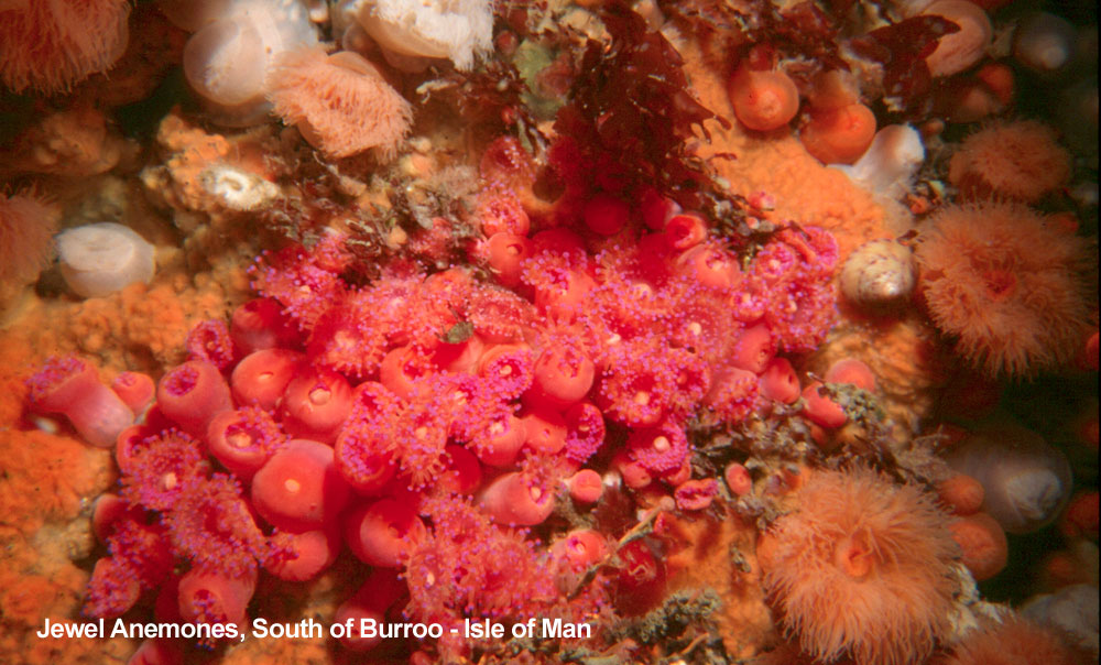
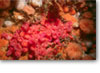 Chough research and regular surveys were undertaken by the Manx Chough Project and are now done by the Manx Birdlife (previously called Manx Bird Atlas). The Manx Bird Atlas was a 5-year project to map the Island’s birds and was completed and published in 2007. The coastline is rich in marine life, including jewel anemones (pictured) which attracts visiting Risso’s dolphins and other cetaceans as well as scuba divers.
 Basking sharks are regular visitors to island waters. British waters appear to hold one of the largest populations of basking sharks in the world; fortunately these close relatives of the great white shark are entirely harmless plankton feeders. Very little is known about the basking shark - except that they are possibly under threat of extinction as they get caught accidentally and deliberately. Previously killed for their oil-rich liver, they are now harpooned for their fins; once the tail and fins are cut-off (for shark fin soup) the shark, sometimes still alive, is thrown back into the sea. The basking shark is gradually disappearing from areas where they were previously common. Various local boats take visitors out on their boat to see sharks and cetaceans. International wildlife travel companies bring small groups of naturalists. Basking sharks are regular visitors to island waters. British waters appear to hold one of the largest populations of basking sharks in the world; fortunately these close relatives of the great white shark are entirely harmless plankton feeders. Very little is known about the basking shark - except that they are possibly under threat of extinction as they get caught accidentally and deliberately. Previously killed for their oil-rich liver, they are now harpooned for their fins; once the tail and fins are cut-off (for shark fin soup) the shark, sometimes still alive, is thrown back into the sea. The basking shark is gradually disappearing from areas where they were previously common. Various local boats take visitors out on their boat to see sharks and cetaceans. International wildlife travel companies bring small groups of naturalists. |
 |
 . .
|
|
|
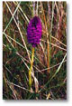
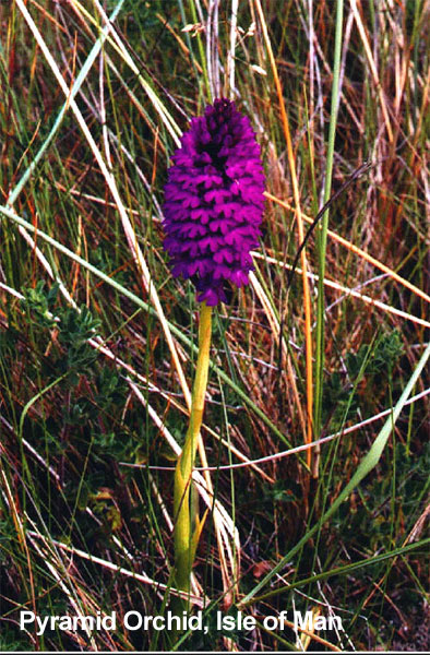
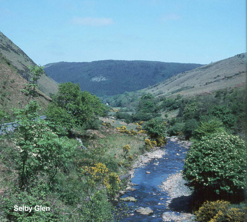
| The Isle sits within a rich marine ecosystem supporting basking sharks (pictured). Terrestrial ecosystems range from hill-land (Sulby Glen pictured) to coastal heath (The Ayres pictured). Much of these and the intervening agricultural land retains elements of traditional farming methods, important for orchids (pyramidal orchid pictured) and the chough (pictured), a bird now restricted to certain uplands and coastal fringes of Europe. |
| Photographs courtesy of the Isle of Man Department of Environment, Food and Agriculture, Manx Wildlife Trust, Maura Mitchell, Martin Withers |
|
 |
|
|
|
|


